Section 3: UPPER
TANANA ATHABASCANS
(TETLIN)
5 to 6 days
OBJECTIVES
1. Students locate Tetlin on map
of Alaska
2. Students correctly identify the language traditionally spoken
in Tetlin
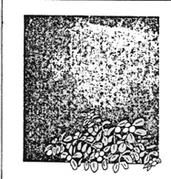
3. Students name 3 animals, 1 species of fish, and a plant
resource that were used for one of the basic needs in the Tetlin
area
MATERIALS
1. Student text, Alaskan
Athabascans
2. Milepost or other road map enrichment)
3. Poster: Tetlin Resource Map
4. Booklet: Tetlin Resource Booklet
5. Student text, Tetlin As I Knew It
6. Worksheet V
7. Handout 3 - Tetlin Resource Map (desk copy)
PREPARATION
1. Tack up Tetlin Resource
Map
2. Make student copies of Handout 3- Tetlin Resource Map (desk
copy)
ACTIVITIES
1. Read Chapter 4 in Alaskan
Athabascans
2. Study the Tetlin Resource Map
3. Identify resources in the Tetlin area
4. Complete worksheet V
5. Add a column to the Basic Needs Chart for Tetlin and begin
filling it in (section l)
6. Read Chapter I in Tetlin As I Knew It. Mark the
locations mentioned in the chapter on the Tetlin Resource
Map.
New Vocabulary:
Upper Tanana
Tetlin
Downriver
Muskrat
READ TEXT: CHAPTER IV IN ALASKAN
ATHABASCANS
Have students read Chapter IV in the student text, Alaskan
Athabascans.
LOCATE UPPER TANANA AREA AND
TETLIN
Ask a student to find the Upper Tanana area and the village of
Tetlin on the Native Peoples and Languages of Alaska map. Mark its
location. Identify the language that is spoken there, and have
students estimate the number of people who live there based on the
information from the map. Discuss how a person might travel to Tetlin
today. (Be sure to differentiate between Tetlin & Tetlin
Junction.
CHAPTER IV
UPPER TANANA ATHABASCANS
The map of Alaska shows
eleven different groups of Athabascan Indians speaking eleven
different languages in Alaska. You don't have time to learn about
every group, so you will concentrate on one group in this unit:
the Upper Tanana Athabascans. As you learn about that group,
remember that each Athabascan area is a little different, and so
are the customs of the people living in each area.
You will be reading a book
called Tetlin As I Knew It. It was written by Shirley Jimerson, an
Upper Tanana Athabascan who now lives in Anchorage but who grew up
in Tetlin. In her book, she describes the way life was when she
was a little girl, in the 1950's. Life changes for people all over
the world, and life has changed in the Tetlin area too. Nowadays
there are more stores, and snowmachines and more people going to
school than there were in the 1950's. Nowadays men
ENRICHMENT: PLAN A TRIP THERE
Provide one or more students with a copy of the Milepost or other
road map of Alaska. Have them chart the route to Tetlin on the map. They should
describe to the rest of the class what type of
terrain and sights will be seen on the way, how long the trip is
likely to take. They should show pictures taken along the route if
they appear in the Milepost.
DISCUSSION
Briefly review the concept of change. Ask students to name some
recent changes they have noticed in their neighborhoods. Then
reiterate the point, mentioned in the text, that life has changed
through the years in Tetlin also. Alert students to be looking for
changes as they read.
don't trap with their
families as much. Instead, they go with friends and leave the
families in town so the children can go to school. And nowadays
more and more men and women are working for money, instead of
surviving from the natural environment.
Life is different now from
the way it was when Shirley Jimerson was little. As you read, try
to find clues to the way life was different for Shirley than for
her mother and father when they were little.
BACKGROUND INFORMATION
Students should be told that Tetlin and the surrounding land are all
part of the Tetlin Reserve, owned by the shareholders of the Tetlin
Native Corporation. The reserve was originally established as an
Indian Reservation by the Department of the Interior. After the
Alaska Native Claims Settlement Act was passed in December, 1971, the
people of Tetlin elected to take full title of the land, which meant
that they had both surface and subsurface rights but did not share in
the original per capita money settlement as part of a regional
corporation. The area is thus off-limits to any hunters or fishermen
who are not members of the Tetlin Native Corporation, unless they
receive permission from that corporation.
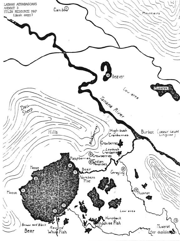
TETLIN RESOURCE MAP
Now direct your students to the Tetlin Resource Map. Explain that
this is a larger scale map of part of the Upper Tanana area shown on
the Native Peoples and Languages of Alaska map.
MAP STUDY
As introductory map study for the students, have them determine how
many miles the map shows from north to south; east to west. What
landforms are most prevalent in the area? Explain to students that
each plant and animal depicted on the map is placed in the locations
where it is most often and easily obtained by the people of
Tetlin.
WORKSHEET V AND TETLIN RESOURCE
BOOK
This multi-page worksheet will be best performed as a class
activity rather than individually. Tack the sheets around your room.
Distribute a copy of the Tetlin Resource Book to every third student.
Give the students their instructions: they are to number a piece of
paper from 1 to 17. Then, using the Tetlin Resource Book, the
students are to identify the pictures tacked up around the room. Give
them a time limit: perhaps 15 minutes. You should be prepared for a
fairly hectic, but fruitful 15 minutes.
RESEARCH RESOURCES: GROUP WORK
Following the identification, assign one resource to each small
group to research. The group must prepare to give a very brief report
on the resource, based on information in the booklet, and must locate
pictures of the resource on the Tetlin Resource Map. (Handout 3,
Tetlin Resource Map (desk copy) identifies the resources. This is to
be distributed to your students later in the lesson.)
After the reports have been completed,
leave the Tetlin Resource Booklets on a table close to the Tetlin
Resource Map so that students can browse through it at their
leisure.
Briefly discuss which of the Tetlin
resources also exist in your area. Compare geography of the two
areas. What types of environments do those common animals
need?
READ TEXT: CHAPTER l TETLIN AS I
KNEW IT
MARK LOCATIONS ON MAP
Next, begin work with the book Tetlin As I Knew It ,by
Shirley Jimerson. Read Chapter I aloud in class and follow Shirley's
travels on the Tetlin Resource Map as you read. Mark with a pushpin
or adhesive dot any places where the author stops.
HANDOUT 3
Refer to Handout 3, Tetlin Resource Map (desk copy). Note that
various locations on that map are numbered. Those numbers correspond
with numbers on the teacher's reduced pages from Tetlin As I Knew
It, and will be an aid to you in determining the places Shirley
describes in her book. At this point, distribute copies of the map to
students so that they can follow Shirley's travels more closely as
you read Chapter I of the book. You might have students mark her
yearly route on the map with crayon or magic marker as they
read.
BASIC NEEDS CHART
As you read about the various resources in the Tetlin area, have
students add them to your Basic Needs chart begun in Section 1. You
will be adding to this chart throughout the unit.
CHAPTER l
A Trip Around Tetlin
Let's imagine we're
looking at the fish campsite - 1 Last Tetlin.
From the riverbank, we can see a tent frame and a smokehouse for
each family. Trails branch out here and there from the campsite.
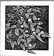
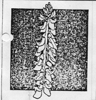
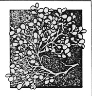
Fireweed is growing all over.
We walk to the back of the
village. From there we can see all the lakes - there are lots of
them - which empty out into the Last Tetlin River.
We take a boat downriver
toward the fish traps. In the clear spots we can look down to the
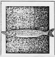
bottom of the river and see whitefish and northern pike swimming
around.
The river curves, back and forth,
so we can't see very far down it from any one place. Along the
banks there are spruce trees and willows, and once in awhile we
have to steer the boat out of the way of a fallen tree that hangs
over the river. As we go down toward the mouth of the river, we
can see that the trees are getting taller and more
dense.
Last Tetlin River empties
into 2Tetlin Lake - the largest lake in
the area. When we enter the lake from the river, we see the
mountains at the far side. They seem to flow into the
lake.
We'll go around the lake
clockwise. The first creek we come to is 3Bear
Creek . It's very clear and ice cold, and there are lots of
fish in it in the summer and fall.
We go on past the creek, along the
lake-shore, until we come to an Island . The lake between the
4Island and the shore is very shallow and is a
favorite place for moose. They feed on the water lily
roots.
All along the west side of the
lake, there are marshy areas like this where moose feed and ducks
of all types can be found.
Tetlin Lake is a major area for
molting ducks in the summer. Canvasbacks, widgeon, pintail,
shovelars, greenwing teal, and some mallards can be found
there.
We'll go on to the
5North side of the lake. The land becomes more
hilly and the shores are rocky. This is one place where my family
fishes.
We'll keep going around the
lakeshore. From the northeast side of the lake we can see a hill
we call 6"Rock Hill" . We pick raspberries on
Rock Hill.
We go past Rock Hill, and the banks
be-come high and steep. We can't see much over the bank from our
boat until we come to the 7mouth of Tetlin
River. Then we can see the area between the mouth of Tetlin
River and the mouth of Last Tetlin River; it's flat and
willowy.
(the canaries referred to are
yellow warblers).
Going up the Tetlin River, we
can see only the high banks for quite awhile. Once in awhile we
can see bears up on the banks-brown or black bears. Common snipes
skitter along the riverbanks. Blackbirds chatter. Woodpeckers
hammer away somewhere in the forest. We hear canaries, chickadees,
and crows, all singing or talking. How beautiful it all
sounds!
Every now and then a creek
empties water out of some small lake into the Tetlin River. There
are lots of willows - river willows - hanging over the
river.
Finally we see
8Tetlin Village. It sits on the left bank of the
river, and we can see it clearly from the place where we beach the
boat. People come down to meet us - it doesn't matter if we're
strangers. They'll come down to meet us anyway!
Before we go inside we take a
look around. The land rises from the village toward the north. One
of the hills, called Tetlin Hill, is a good place to find
blueberries and cran-berries. And to the south of the village, the
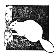
land becomes marshy. That's where the muskrat and beaver can be
found.
From Tetlin Village we can follow a
trail anywhere we want to go - all over our land. But that's a
different journey!
WORKSHEET V
Tetlin Resources
A list of resources on the Tetlin
Resource Map is given below. With the help of the Tetlin Resource Booklet, label
the
pictures of the resources.
|
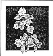
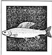
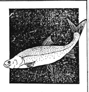
Arctic Grayling
|
Crowberries
|
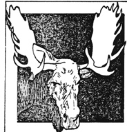
Moose
|
|
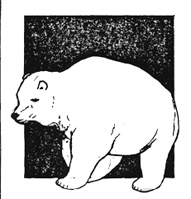
Bear
|
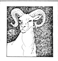
Dall Sheep
|
Muskrat
|
|
Beaver
|
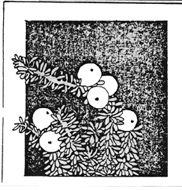
Highbush Cranberries
|
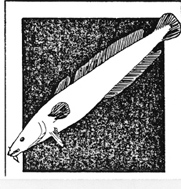
Northern Pike
|
|
Blueberries
|
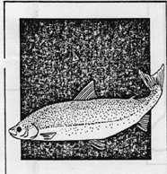
Humpback Whitefish
|
Raspberries
|
|
Burbot
|
Indian potatoes
|
Round Whitefish
|
|
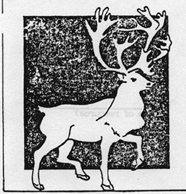
Caribou
|
Lowbush Cranberries
|
|
1. Name of
resource_________________________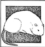
2. Name of
resource_________________________
3. Name of
resource_________________________
4. Name of
resource_________________________
5. Name of
resource_________________________
6. Name of
resource_________________________
7. Name of
resource_________________________
8. Name of
resource_________________________
9. Name of
resource_________________________
10. Name of
resource_________________________
11. Name of
resource_________________________
12. Name of
resource_________________________
13. Name of
resource_________________________
14. Name of
resource_________________________
15. Name of
resource_________________________
16. Name of
resource_________________________
17. Name of
resource_________________________
Answer Guide
WORKSHEET V
Tetlin Resources
|
1. Muskrat
|
7. Blueberries
|
13. Beaver
|
|
2. Lowbush
cranberries
|
8. Dall sheep
|
14. Arctic grayling
|
|
3. Raspberries
|
9. Bear
|
15. Round whitefish
|
|
4. Indian potatoes
|
10. Humpback
whitefish
|
16. Moose
|
|
5. Northern pike
|
11. Burbot
|
17. Crowberries
|
|
6. Caribou
|
12. Highbush
cranberries
|
|
HANDOUT 3
TETLIN RESOURCE MAP
Desk Copy

 Athabascans
of Interior Alaska
Athabascans
of Interior Alaska